How Directional Drilling Works in Huntsville Ground
Red residuum, dissolving rock, and the cave-country ethic
The valley's recipe is consistent: flat-lying limestone bedrock beneath a blanket of chert-laced red residuum — the insoluble leftovers of rock that spent geologic time dissolving — with ledge depth varying as the old karst plumbing dictates and the mountains standing apart as sandstone-capped plateau outliers. The drilling consequences are threefold: residuum bores cooperatively but abrades tooling with its chert; ledge depth is a verified fact, never an assumed one; and the dissolved rock below demands manners — conservative pressures, monitored returns, void-aware profiles — because this is genuine cave country, and the region's ethic treats the karst's connected plumbing with respect. Our quotes carry all three as the valley's standing conditions.
Federal-campus tempo and the growth curve
Two clocks govern north Alabama work. The federal one: the arsenal's campus economy — Army, NASA, FBI, and the contractor ring — runs gate coordination, documentation fluency, and installation-owner standards as everyday machinery, polished by seventy years of practice. The growth one: the Southeast's fastest-expanding metro loads permit queues, utility programs, and plat calendars at a tempo that rewards contractors who file early, complete, and correct. Neither clock forgives improvisation; both reward the desk-first discipline our quotes are built on.
The sequence, Rocket City edition
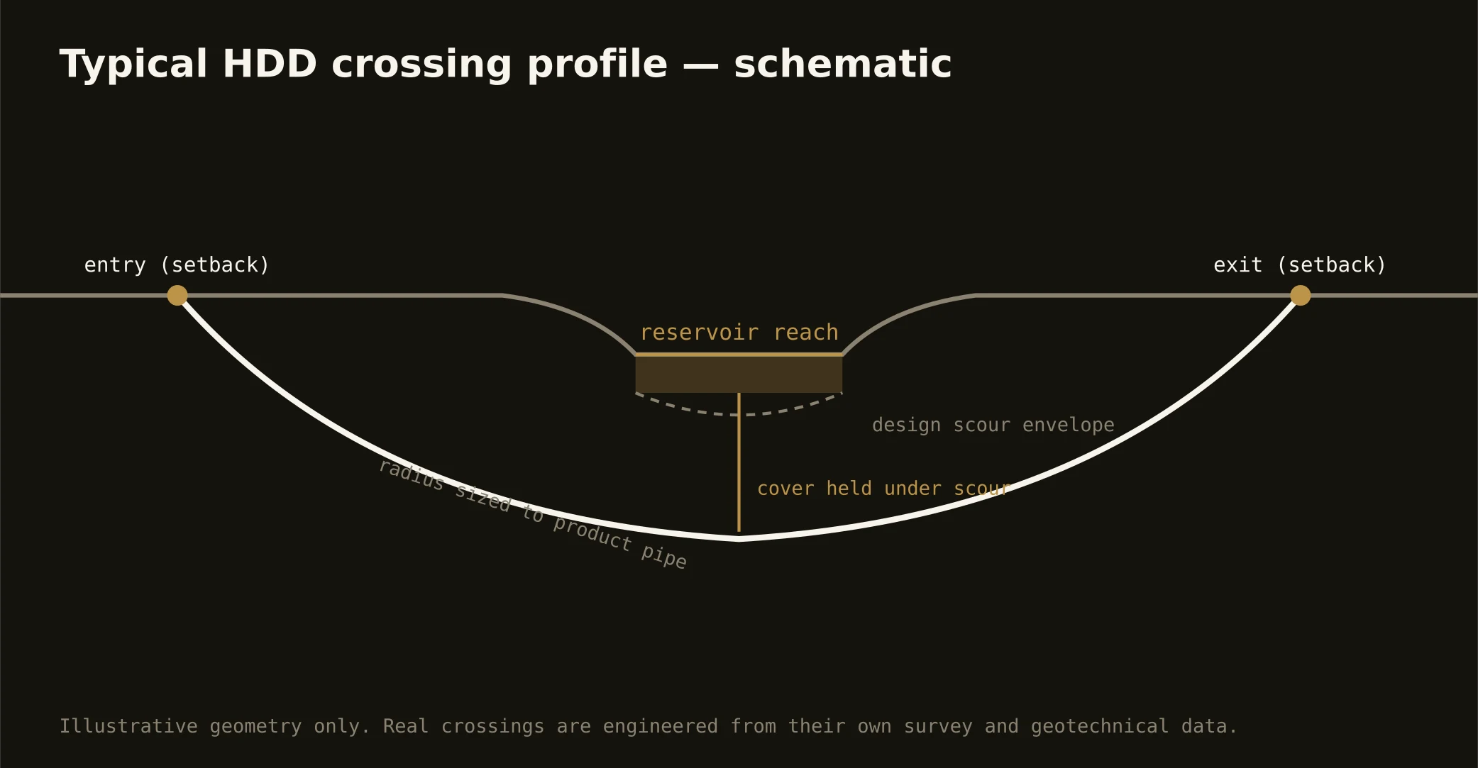
The bones are standard — locates plus private designating, potholes on every claimed utility, pilot on profile, ream to about one and a half times the product, pull, restore. Rocket City bends: chert-rated tooling as the working assumption, ledge verification where depth matters, cave-conscious fluid manners on the valley floor, gate-corridor coordination where the boundary applies, tornado-season staging awareness, and restoration that treats boom-plat lawns, mountain-shoulder lots, and arsenal-gate corridors with their due care.
Who owns what you're crossing
The cities run their own ROW counters; three county departments cover the roads between; ALDOT permits I-565, I-65, and the parkway spines. The reservoir agency governs the lake's shoreline world with navigation review on the channel and the refuge's habitat seriousness on the protected shore; state water-quality machinery rides the cave-fed streams; the arsenal's boundary brings federal coordination to its corridors; railroads permit the riverfront and plant serve. The quote names every owner on your alignment — here, the first questions are how deep the ledge runs and how close the gate sits.
Straight answers
Will you hit rock on my bore?
The valley's answer is 'at a depth worth verifying': limestone floors everything under residuum whose thickness varies with the old karst plumbing, so shallow bores often ride the red ground clean while deeper profiles meet the ledge. The quote states the assumption and the verification plan — cave country rewards exactly that honesty.
How deep do bores run under Huntsville streets?
Cover follows the owning authority's standard and sits below everything potholed on the alignment — with lake-world crossings running to the reservoir agency's criteria and deep profiles carrying ledge verification. The plan states your number and what the rock is expected to do at it.
Does the cave country actually affect utility work?
As an ethic more than an obstacle: the karst's plumbing is connected — springs, caves, and groundwater in one system — so fluid discipline, containment, and clean disposal run standard on the valley floor, with extra care flagged near mapped systems. It's the same respect the region's cavers and biologists model, applied at the rig.
Ready to put a number on a real crossing? Send the scope — a person prices it.